I realize that this map is probably not politically feasible. It would undoubtedly create two seats – perhaps even three – where Democratic candidates would stand a very good chance of winning. But I drew it because I wanted to see a map made, using actual 2010 census data, that stayed as close as possible to the spirit of the VRA. The VRA is not designed to ensure the election of particular minority candidates; it is to maximize the electoral chances of minority voters, where it is possible to create compact districts (part of the Gingles test), to choose candidates of their choice. I believe this map does this with the 2nd and 4th districts. I also wanted to see whether the already VRA-protected 2nd district needed to go to Baton Rouge as has been talked about a lot ever since it became apparent in the aftermath of Katrina that Louisiana would almost certainly lose a congressional seat. It turns out that the answer is probably not – I say probably because I am not sure whether a VRA district needs to have just 50.0%+1 of total population be black or 50.0%+ of the voting age population. If the latter is the standard, I am sure the districts can be tweaked somewhat to comply. Follow me in the jump over to look at the six districts individually.
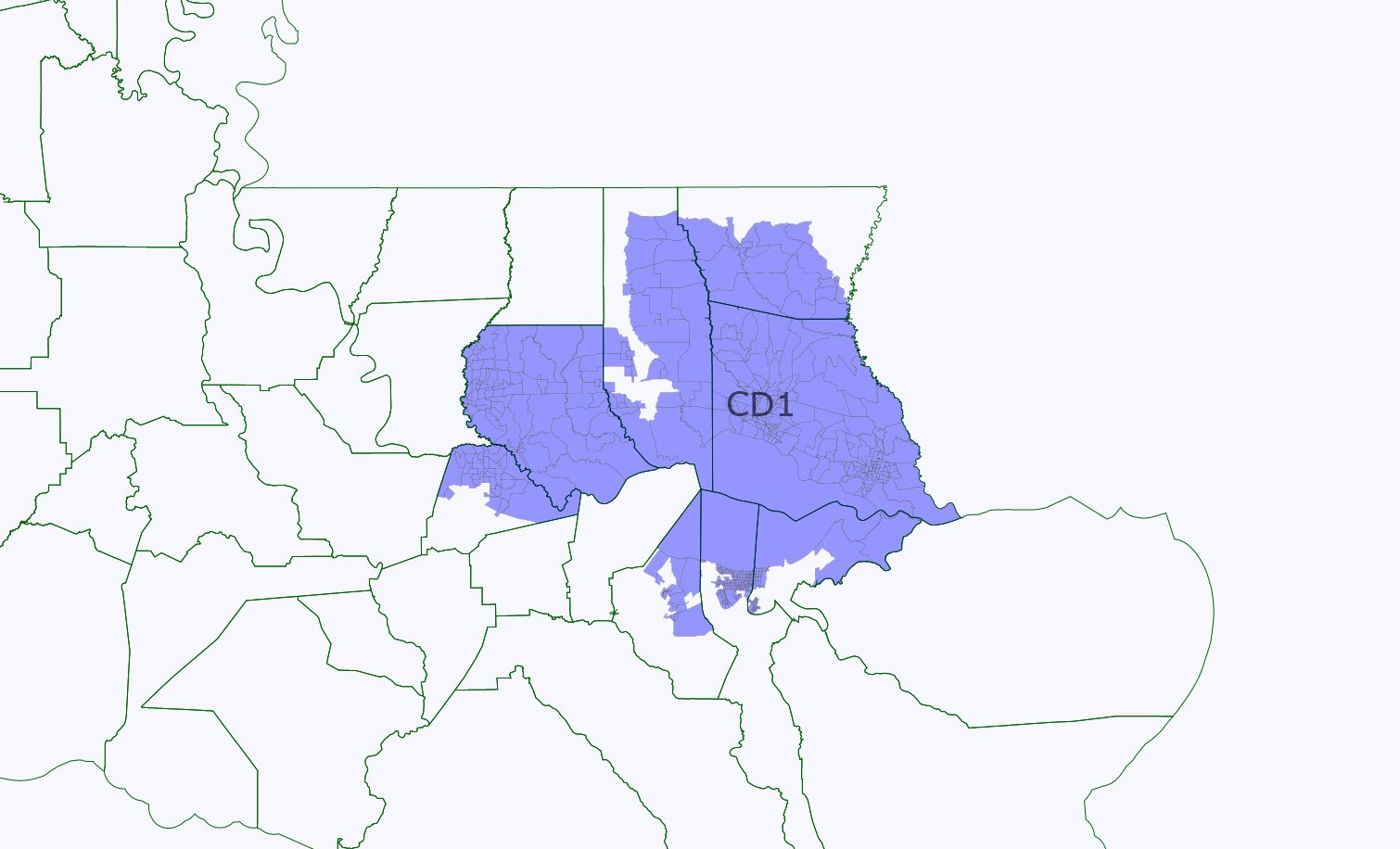
District 1 (blue) SAFE GOP
W 81.9%, B 9.2%, H 5.7%, A 1.5%, NA 0.3%, Other 1.4% (W 83.9% of VAP)
Not many changes from current map. Extends all the way to Baton Rouge with the addition of Livingston County.
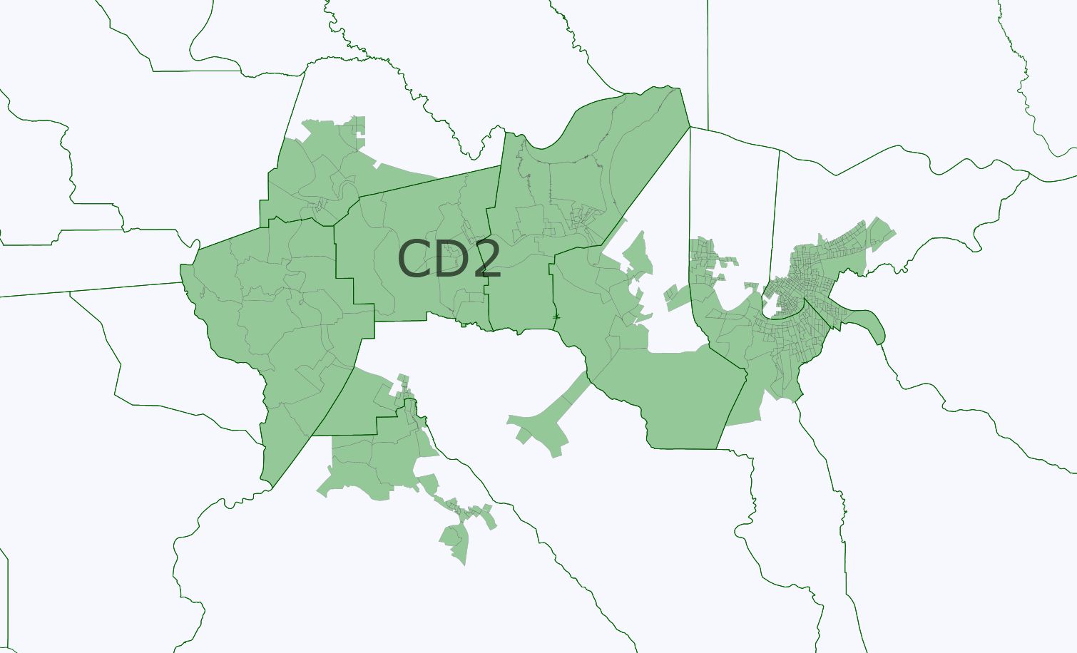
District 2 (green) SAFE DEMOCRATIC VRA PROTECTED
W 35.7%, B 51.8%, H 7.8%, A 2.9%, NA 0.4%, Other 1.4%
W 38.9%, B 48.8%, H 7.7%, A 2.9% VAP
I believe this would past judicial muster because the 48.8% Black voting age population (VAP), combined with Hispanics, “Other” (which undoubtedly is mixed or multiple races) and Asians, clearly is majority-minority. If it needs another 1.2% African-Americans the map can probably be tweaked. I wanted to see whether you needed to go to Baton Rouge, and the answer to me seems clearly not. Thus, if a post-2010 map of Louisiana has the 2nd district going into downtown Baton Rouge, that is for GOP partisan purposes, not because it has to be drawn that way.
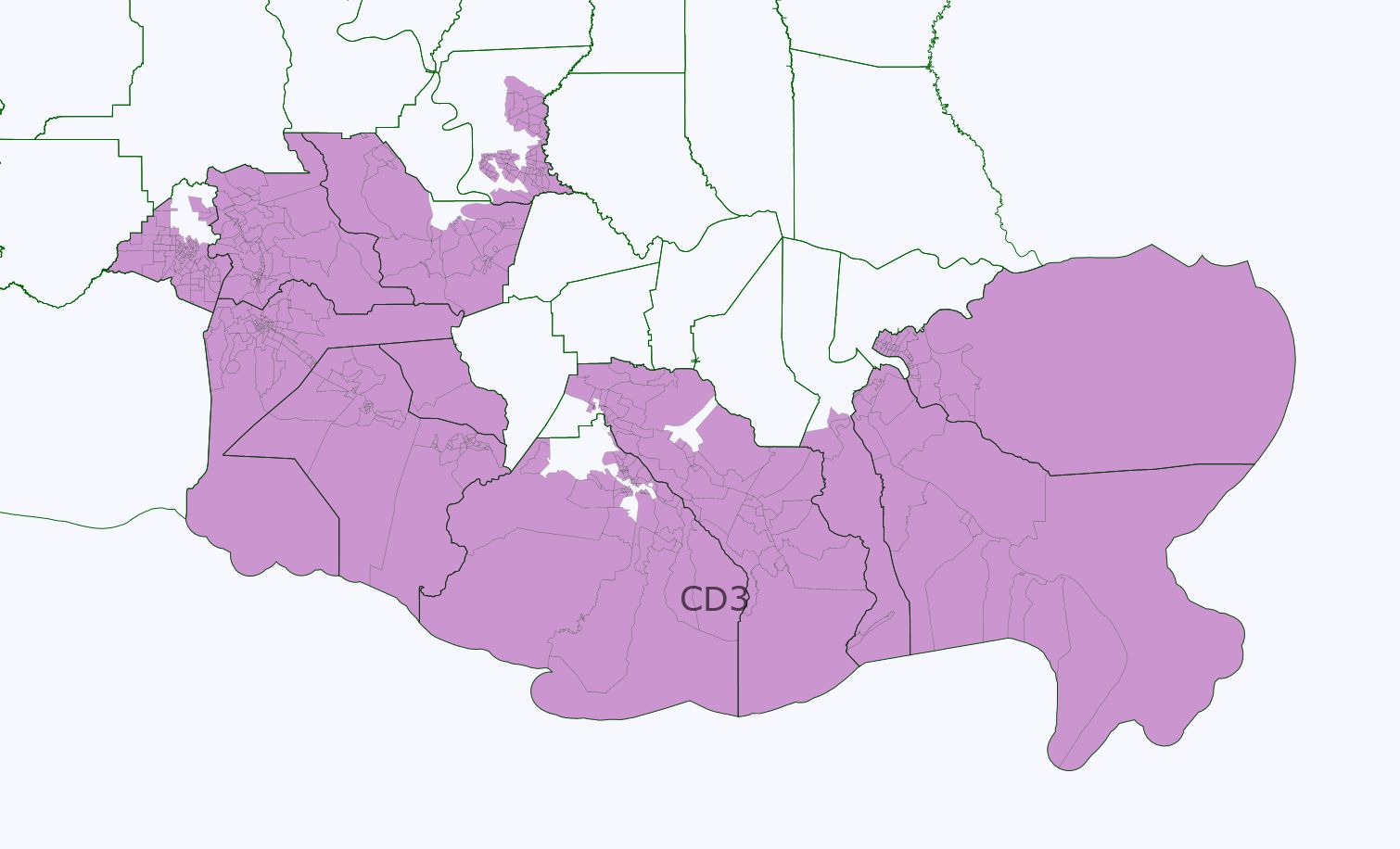
District 3 (purple) LIKELY GOP
W 72.6%, B 18.4%, H 4.1%, A 1.9%, NA 1.4%
W 75.1% VAP
I only hesitate to label this “Safe Republican” because until recently this third district elected a conservative Democrat to congress. Probably with the addition of white areas of Baton Rouge and Lafayette, though, it is more Republican.
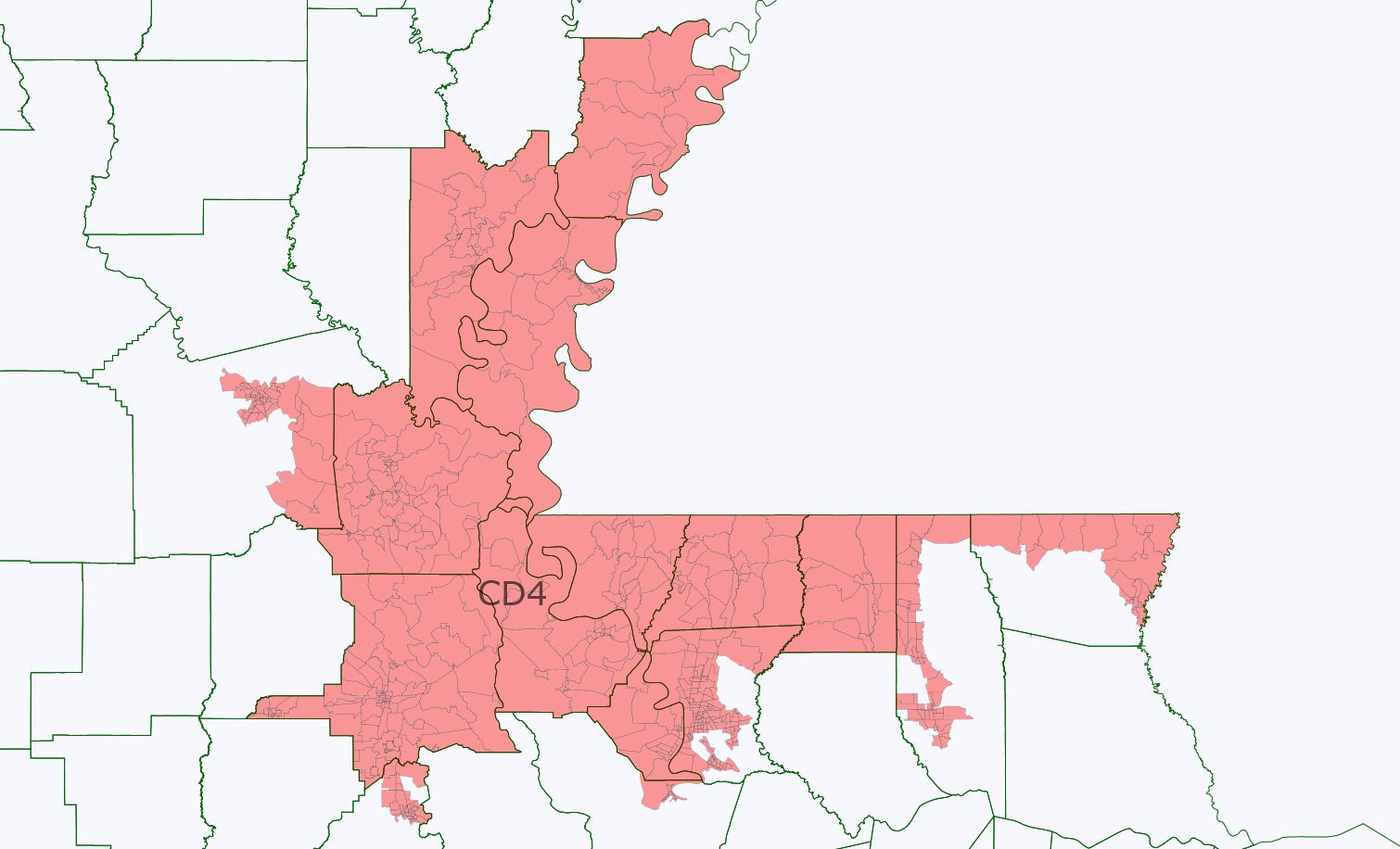
District 4 (red) LIKELY DEMOCRATIC NEW VRA DISTRICT
W 42.9%, B 51.7%, H 2.6%, A 1.3%, NA 0.3%, Other 1.2%
W 46.3%, B 48.7%, H 2.5%, A 1.3%, NA 0.3%, Other 0.9% VAP
Again the same caveat applies as in District 2: I am not sure whether, to pass VRA muster, a district merely needs to be above 50% population and meet the other Gingles criteria, or also has to have a VAP above 50%. However, I believe this map would pass the retrogression test because it creates two Black-majority districts rather than just one (and comes close to the proportion of a state that is almost one-third black). If it needs to be tweaked to get the VAP over 50%, it would probably involve a few more country splittings.
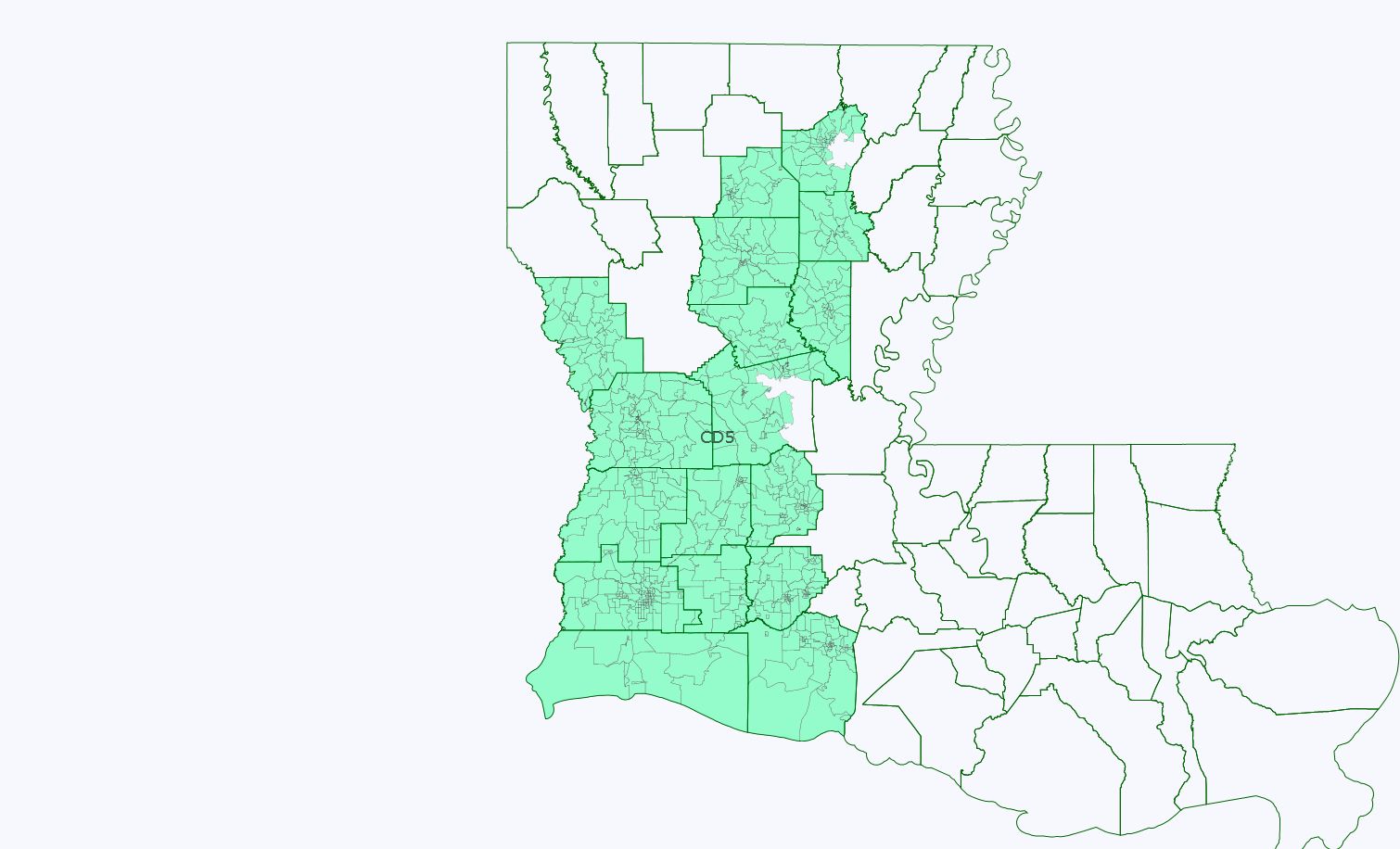
District 5 (light green) LIKELY GOP
W 75.9%, B 17.9%, H 2.7%, A 0.9%, NA 0.8%, Other 1.6%
W 77.7% VAP
I hesitate only in labeling this a safe GOP seat because it does contain the Cajun Country part of Louisiana, that until recently elected a Democrat to Congress.
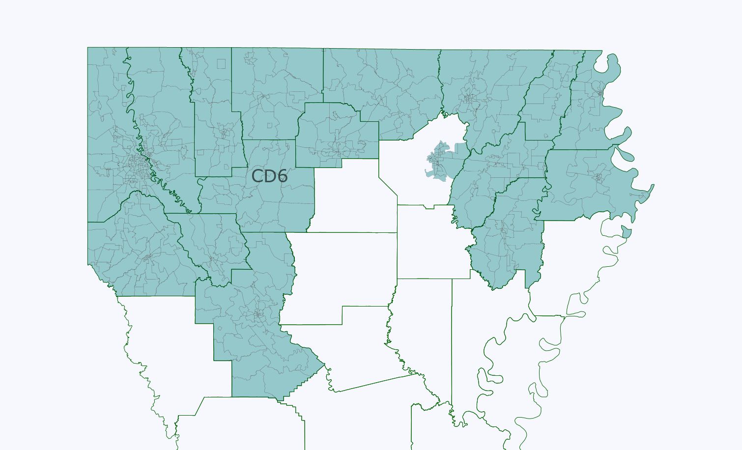
District 6 (teal green) “Black influence” district LEAN DEMOCRATIC OR JUST TOSS-UP?
W 52.9%, B 41.9%, H 2.7%, A 0.9%, NA 0.4%, Others 1.3%
W 56.0%, B 39.4% VAP
Not sure whether this should be properly classified as a lean Democratic district or as a toss-up. My caution comes from the stark degree of racial polarization in Deep South states like Louisiana, as witnessed in the 2008 election. But it would give African-American voters the possibility to influence the choice of candidates in Louisiana’s jungle primary, thus meeting one of the Gingles tests. And it does this with only one county being split. A minority-majority district in this area of the state is probably possible, but might fail the compactness portion of the Gingles test (aka Cleo Field’s 1992 Z-shaped district).
Will this map likely be enacted? Probably not. But it should at least be considered given the VRA’s requirements, which it falls to the Obama Justice Department to insist on. It seems clearly possible in my view to create two VRA-compliant districts in Louisiana that are relatively compact and adhere to communities of interest (in other words, recognizing that Baton Rouge residents have different concerns than those of New Orleans).
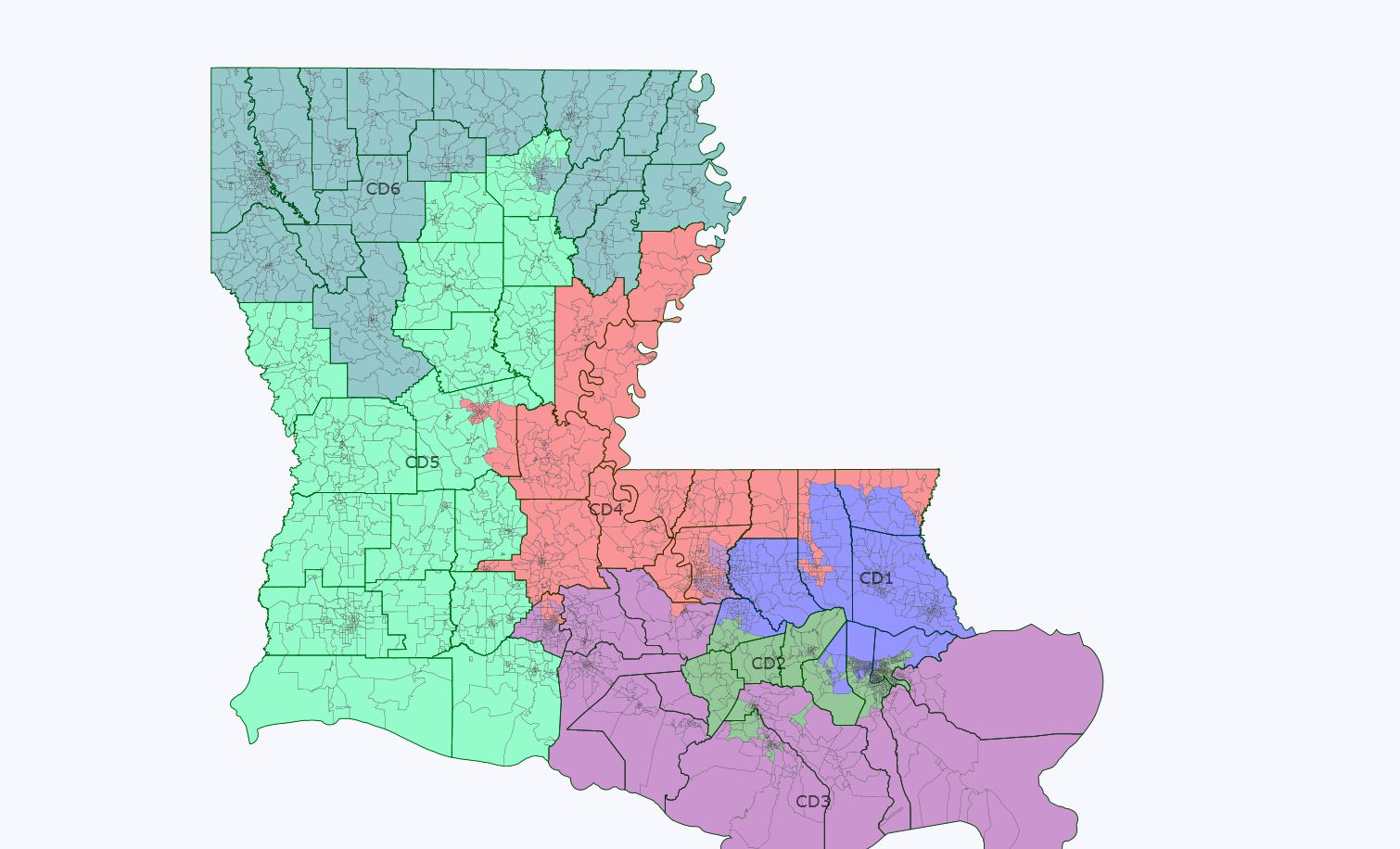
In a state that’s currently 6-1 GOP, there’s only 1 “safe R” district?
I’m not an expert by any means, but just looking at the map I’d call your district 6 “likely R”, and your districts 3 and 5 “Safe R”.
I’d rather put the white parts of New Orleans in the New Orleans district, than have it extend out to rural black voters 50 miles away. It would still be safe Democratic, but unfortunately not VRA-compliant.
In 2010 in the Deep South, how high of a percentage of a district’s vote did the black vote have to be for a Dem to win? I ask because with low black turnout and high conservative turnout I wonder if a Republican could have won a 46-47% black district?
The official 2010 census data is already in DRA? I may have to re-do my LA maps if so. Interesting maps though. Its a lot cleaner than I would expect with two VRA districts in LA. Interesting that there is a good district for Cleo Fields- he is being talked about as a candidate in LA-02 if it takes in enough of Baton Rouge.
I think a map like this indicates that a New Orleans to Baton Rouge district that is 65% black would not be pre-cleared under section 5 of the VRA by the Obama DOJ or probably the DC Circuit either.
There are still some issues. Drawing a district that combines part of Monroe with Lake Charles?
Shreveport and Monroe have long complained every time someone tries to put them together that it basically leaves 1 representative for the Northern Parishes. You can’t tell me that the Lake Charles guy is really going to go to bat for North Louisiana.
Well, you CAN tell me that, I just won’t believe you.
District 2 (Green)
53.2% Black, 36.2% White, 6.3% Hispanic
50.8% Black VAP, 38.9% White VAP, 6.2% Hispanic VAP
District 6 (Yellow)
53.1% Black, 41.9% White
50.0% Black VAP, 45.4% White VAP
Without going to the lengths of creating a “Mark of Zorro” circa 1991 district, it is possible to create two relatively compact districts that are majority African-American. And to do it in a way that doesn’t put Lake Charles and white areas of Monroe in the same district, which was a fair critique of the earlier map.
It’s pretty similar to yours and its compact. The overall black population in the 6th is 53.5% and over 18 its 50.6%. I really hope people in the Deep South start suing under Section 2 if additional VRA districts aren’t created.
Green 2nd district (centered on New Orleans)
Blacks 53.0%, VAP 50.2%
Yellow 5th district (Baton Rouge, Alexandria, Shreveport)
Blacks 54.6%, VAP 51.9%
Louisiana locals, which of the three options that I presented makes the most sense “politically?”