Okay, so, Maryland has the trifecta, and it’s not afraid to use it. Republicans get to carve up some states they control in particularly nasty, ugly ways (I’m not looking forward to seeing how Augusta determines to create a 1-1 split, probably ousting Rep. Michaud in the process; North Carolina will be a veritable bloodbath in redistricting, and New Jersey won’t be much better), so I think Democrats should get to fight back in states like Maryland, Washington, and hopefully New York.
So, without further ado, I present to you a positively wicked 7-1 redistricting proposal for my state of residence.

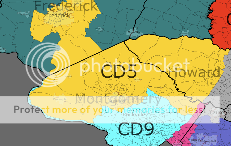
Let’s start with MD-01. I guess the app decided to plop the “CD01” right where D.C. is, so just to be clear, I’m not advocating Maryland annex the nation’s capital as its new 1st congressional district.
MD-01 is pretty straightforward. I chopped most of the population centers out of Rep. Bartlett’s MD-06, including the swing city of Frederick, and combined it with Rep.-elect Harris’s Eastern Shore district, now with 100% less Anne Arundel County. Back to that in a second.
The important thing about MD-01 is that it’s the Republican district. According to the app, this hypothetical new MD-01 gave Sen. McCain 58% of the vote in 2008, with only 40% for the skinny Illinois senator we now know as President Barack Obama. This MD-01 would not be the safest Republican district in the country, but it’d be pretty safe.
Next up, MD-02. It was roughly at this point that I realized how messed up the current congressional districts of Maryland are. It’s bad enough to include parts of Anne Arundel County in a district with the Eastern Shore, but the way in which Rep. Ruppersberger’s district is drawn would be punishable by death in some countries.
What I decided to do is simplify things without sacrificing, well, let’s call it functionality. I also needed a way to swallow up some populous parts of MD-01, namely most of Baltimore County and parts of Harford County. This MD-02 includes parts of Baltimore City, although less than is currently drawn into the district because it no longer slithers south into Anne Arundel County. I mean, come on, guys.
The tradeoff of consolidating MD-02 with an eye toward siphoning off conservative MD-01 constituents and balancing them with ultra-liberal North Baltimore (the parts of Baltimore City included are a mix of super-white and super-black precincts, because a Democrat is a Democrat and we don’t make bones about it in MD-05) is that the district isn’t quite as solidly Democratic, but it’s hardly a swing district in an average year. Obama won this hypothetical MD-02 with 57% of the vote; McCain scraped up 41%.
And now for MD-03. If the current MD-02’s blatant and bizarre gerrymandered shape merited the death penalty, the lawman would bring back hanging, drawing, and quartering for MD-03. Staunchly liberal Rep. Sarbanes holds court over this district, drawn for the benefit of white dudes just like him, right now.
Because the way MD-03 is drawn right now is just plain stupid and there was still some of Harford County that needed addressing, I decided to run the new MD-03 from a tiny portion of western Cecil County, technically part of the Eastern Shore, into southern Baltimore County, with some spillage into northern Anne Arundel County and a weird little tentacle extending briefly into Howard County. It also includes the lion’s share of Baltimore City. I’ll grant it’s not tons better-looking in my drawing than it is now, but at least I didn’t gerrymander it for the benefit of those poor besotted white Democrats.
My version of MD-03 is DemStrong, having gone 60% for Obama to 38% for McCain in 2008. It’s now 30% black, proportionally almost twice what it is now, but if Sarbanes or some other white Democrat can’t get African Americans to vote for him, that’s his problem.
On to MD-04. I don’t know why this district is drawn so weirdly right now, because I feel like the way I’ve drawn it makes a lot more sense. Oh, I’ve got it: it’s gerrymandered to be majority-black. Rep. Edwards, who is a damn good congresswoman, represents our current version of MD-04.
My version of MD-04 covers about half of Montgomery County, a few conservative precincts in Howard County I didn’t want going elsewhere, and most of northern Prince George’s County. It would become the new home of the University of Maryland, which doesn’t hurt a Democrat’s vote share.
Indeed, this version of MD-04 went for Obama 75-24. That’s dominating. I could probably feed more of Howard County into this district if I wanted to, but I decided to keep things as even as possible between the eight (2000 population for all is between 661,000 and 663,000, by the way).
MD-05 is my district. I switched around some parts of the eastern D.C. suburbs for compactness, although my incarnation of the district now represented by Rep. Hoyer, the House majority leader for not a whole lot longer, still has a weird finger extending into northern Prince George’s County, capturing Greenbelt and a few other mid-sized suburbs.
The majority-black eastern suburbs more than balance out swingy southern Maryland in my drawing of MD-05. This new district would actually be majority-black according to the 2000 Census, which says 51% of its hypothetical constituents are African American.
As you might expect, this MD-05 is heavily Democratic. It would have broken 77-23 for Obama if it had been a district back in 2008; either way, that’s what the voters who would be within its new boundaries did.
MD-06 is fun. It’s a completely different district in its present form, being the domain of arch-conservative Rep. Roscoe Barlett in northern and western Maryland. As mentioned before, I had MD-01 consume most of MD-06, so this new district is more fun.
This MD-06 is not the most fun, but it’s certainly the most all-new, because I basically carved it out of parts of the current MD-01, MD-03, and MD-04. It’s basically almost all of Anne Arundel County plus a good chunk of Prince George’s County, including Bowie, a midpoint city between D.C. and Baltimore.
Ultra-liberal Bowie and somewhat liberal Annapolis serve to balance out conservative Anne Arundel County. Voters in this hypothetical MD-06 broke 57-41 for Obama, which is not so bad when you consider the current version of MD-06 has a PVI of R+13.
Helping mop up is MD-07. Right now, MD-07 is a majority-black district represented by Rep. Cummings and covering most of the black neighborhoods of Baltimore City and Baltimore County, as well as most of Howard County. It had to take a hit, and I apologize for that.
There was a lot of the current MD-06 to split up, and a good portion of it was awarded to this proposed MD-07. It’s basically the current MD-07 with a few neighborhoods in Baltimore City split off and given to MD-02 and MD-03, then a huge swath of Carroll County and about a third of Frederick County absorbed for population balance. It’s a lot bigger, but it’s not abnormal population-wise (still falls within that range I mentioned earlier, at least under the 2000 Census).
Despite expanding to cover so large an area of rural, conservative Carroll County, this MD-07 would remain a Democratic stronghold. It broke 2:1 for Obama in 2008. It’s only 39% black with so much of mostly-white Carroll and Frederick counties added in, but a Democrat should be able to walk away with any election here regardless of race.
Last but not least, MD-08. Currently represented by plucky DCCC chair Rep. Van Hollen, the present version of MD-08 covers most of Montgomery County, in particular the eastern, whiter parts of Maryland’s richest county-level subdivision.
I decided I could put it to better use, so I gave parts of Montgomery County to MD-04 without radically changing the boundaries, and then I expanded up into Frederick County and parts of southern Washington County. This is where the city of Frederick, which broke fairly decisively for Obama in 2008, wound up.
The new MD-08 would have a 2008 voter breakdown almost identical to that of MD-07. 66% of its voters went for Obama; 32% of them went for McCain. It’s only 10% black, because of how predominantly white Frederick County and the parts of Montgomery County is covers are.
So there you have it. It can be done. Let’s hope Annapolis pulls the trigger, because we shouldn’t let the Republicans have all the fun in 2012 redistricting.