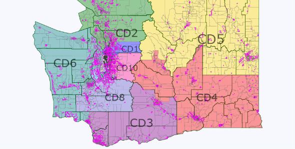
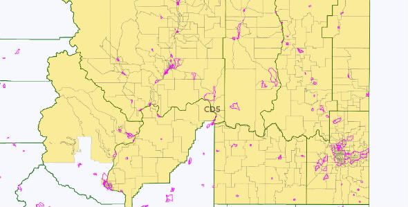
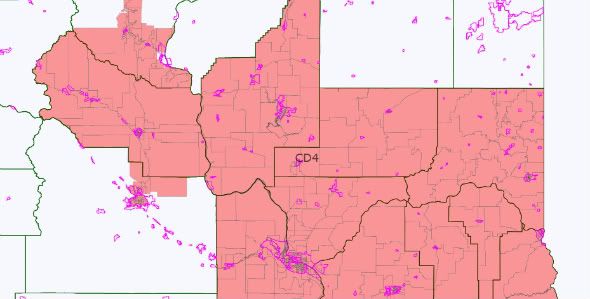
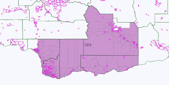
At the Washington State Democratic Central Committee meeting this past January, over lunch the delegates discussed the ramifications of the addition of a 10th Congressional District in the State. The goals discussed in the meeting was to ensure that a Democrat would be elected in the new 10th. There was general recognition that the 3rd would go from Vancouver to the outskirts of Yakama (along the Columbia River).
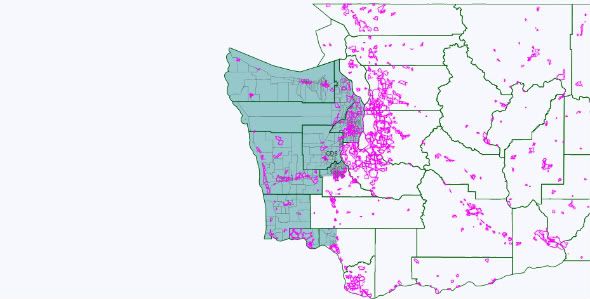
With three districts generally accounted for (the 3rd, 4th and 5th), the main question becomes how the Puget Sound area is divided. In Washington, the redistricting law states that plans should consider electoral competition and not purposefully favor or discriminate against any political party (among all of the normal provisions).
In practice, this means that the bipartisan redistricting commission gets the sign-off by the elected representatives (encouraging little change in the composition in the district, both geographic and partisan). For 2011, this means that Representative Dicks will want a more Democratic district (especially if he loses parts of Tacoma), and Representative Reichart wants a more rural, and Republican district.
With the addition of a 10th District in Washington, the choice facing the redistricting commission is to create 6-8 safe districts (3 safe Democratic 3 safe Republican) or to create a map with 4 safe districts (2 D – 2 R) and another 4 districts that are likely Democratic. (The difference really is should Democrats want to lock in a third safe Republican district in eastern King, Pierce, and Thurston counties or draw a map that is 7-3 in most years [including 2010]).
If the goal is to create 7 Democratic (or competitive) districts west of the Cascades (creating a 7-3 [or in the worst years a 6-4] split), then the existing Representatives should be willing to trade a bit of comfort and security for the potential for more Democratic representatives from Washington.
Some basic rules for redistricting in Washington:
1) While it may be the dream of many Democrats to split Seattle, it is not going to happen. The commission respects geographic cohesiveness, and sending a spur from Seattle to a) the Olympic Peninsula, or b) to Kirkland or Bellevue is not going to happen.
2) The redistricting commission likes to create competitive districts.
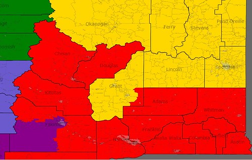
3) Two and a half districts will be in Eastern Washington.
Redistricting Washington
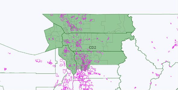
So, 6 districts left to draw. Two districts will have their roots in Whatcom, Skagit and Snohomish County. Representative Larson lives in Lake Stevens, west east of Everett. However, if Representative Inslee runs for Governor, then Larson could either run in the 1st or 2nd (and could be happy either way, since he would want more of Everett anyway).
For me, the key to redistricting Washington lies with not where the new 10th District goes, but what will the 6th District go? And, what does Representative Norm Dicks want from this round of redistricting?
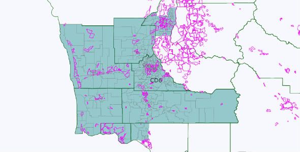
The current 6th District includes Bremerton, Representative Dicks' residence, most of the Olympic Peninsula, and extends into Pierce County and has to shed 37,000 people.
If Representative Dicks gets anxious and wants a district that a) resembles his current district and b) becomes more Democratic, then the Democrats lose the redistricting game (and likely all decade). Either the 10th or the 8th District will be a Solid Republican district. If he is a team player, and accepts a Democratic leaning district that has lots of new constituents, Democrats win (or have a better chance of winning). Then, the 8th and 10th will be lean Democratic seats (or better).
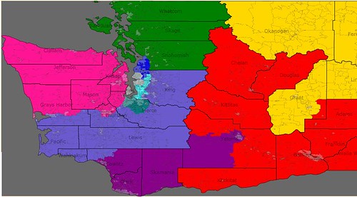
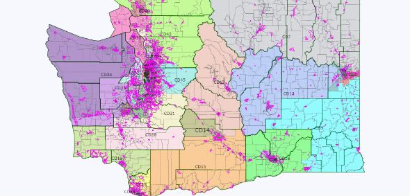
The following maps present two options for a 10th CD and the competitiveness of each district (again, the 3rd, 4th, and 5th stay the same).
Option 1: Dicks remains concerned about his reelection
In this scenario, the 6th CD is the entire Olympic Peninsula, the Washington Coast, and most of Cowlitz County and the cities of Olympia, Tumwater and Lacey. While losing his portion of Tacoma, Dicks gains the remainder of Democratic-leaning Kitsap County, and Democratic leaning Olympia. While Dicks is secure about his reelection, the population of the state mean that a Republican-leaning district must be created.
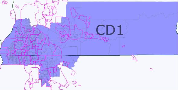
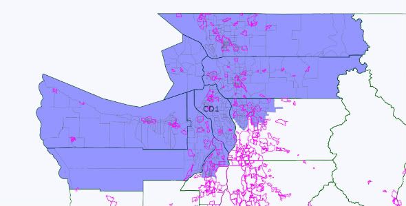
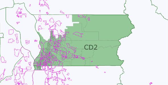
With the Olympic Peninsula off the map, the 1st and 2nd become located entirely in Whatcom, Skagit, and Snohomish County. The 2nd adds Everett, making Larson happy. The 1st (open) becomes southwestern Snohomish counties and several King county cities – Shoreline, Lake Forest Park, Kenmore, Redmond, Bothell and Woodinville.
Up to this point – good for the Democrats – 3 stronger seats.
South of Seattle, Representative Smith's (Tacoma) district can also be strengthened – include all of Tacoma and western Pierce County, and include the cities of Kent, Renton, Federal Way, and the other cities immediately South of Seattle not part of the 7th.
So, 4 stronger seats for the Democrats (and all geographically compact).
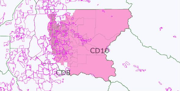
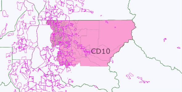
Now the rub. there are few Democratic areas left in the State to draw two more competitive districts (or better). The 10th ends up in Eastern King County centered around Bellevue. This is the area where Democrats have done well in 2006, 2008, and 2010.
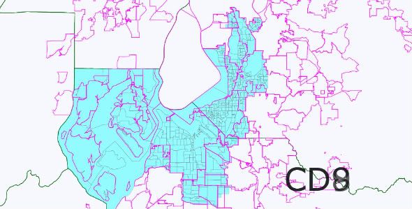
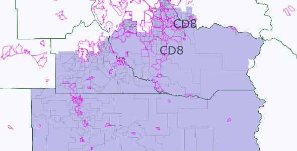
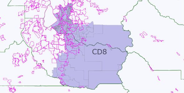
The elusive 8th district becomes the remainder of the State – Auburn, Eastern Pierce County, Lewis County, and rural portions of Thurston County.
So, the end result of Western Washington is 1 SR seat and 4 safer Democratic seats. In essence, this is the status quo and Washington's delegation would be 6-4 for the majority of the decade (with the slim possibility of winning back the 3rd).
But Democrats could do better.
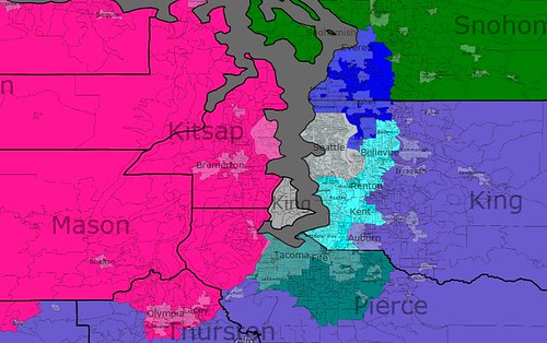
Option 2: Dicks accepts a district with more new constituents
The 6th CD includes Bremerton and other Democratic portions of Kitsap county (Bainbridge Island), Olympia and all of Thurston County, and Pacific, Wahkiakum counties (as well as Lewis County). Every county (or portion of) the county is Lean D (or better) except for Lewis County. While the District would be lean D, and potentially competitive, it would still likely be a Democratic seat the entire decade.
With 2 counties and portions of Kitsap on the Olympic Peninsula not part of the 6th, you then draw a district across the Sound to Whatcom County (via Island and San Juan Counties). The 2nd CD can be all of Snohomish (with a portion of Democratic Shoreline).
So, here we have 2 likely Democratic district and 1 safe Democratic districts.
The 8th CD becomes a Democratic leaning district by adding the King County cities of Federal Way, Kent, Renton, Tukwila, Newcastle and SeaTac. While Representative Reichert still lives in the district, he has lots of new Democratic cities to deal with.
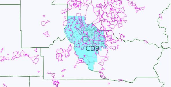
The 9th is a Pierce County district centered around Tacoma.
Again, this is two additional lean/likely Democratic districts.
The new 10th is now exclusively an Eastern King County district.
In this scenario, each district would be competitive (at worse for the Democrats), but likely, year in and year out, sending 7 Democrats to DC.
And, did I say from the outset that the commission likes competitive districts?
To summarize:
Option 1 (max deviation 174):
3 safe Democratic seats, 3 lean/likely Democratic seats, 3 safe Republican seats, 1 likely/lean Republican seat.
Option 2 (max deviation 140):
2 safe Democratic seats, 2 safe Republican seats, 4 lean/likely Democratic seats, 1 likely/lean Republican seat.
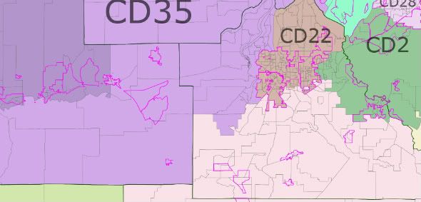
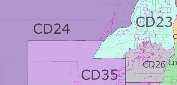
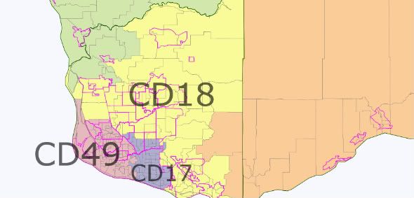
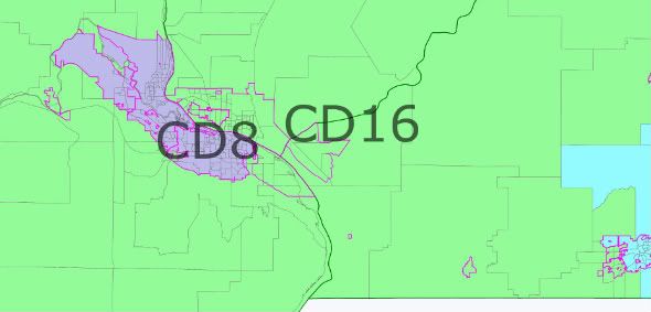
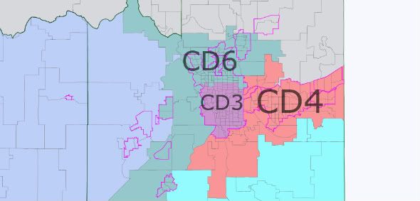
Bonus – State Legislature Map (max deviation 590):
Snohomish County
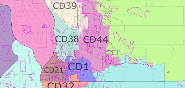
King County
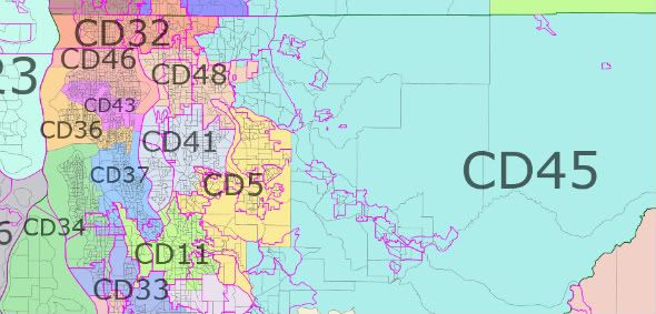
Pierce County
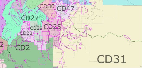
Thurston County
Kitsap County
Clark County
Benton County
Spokane County

Loading ...